Grand Canyon National Park Map Library
South Rim routes, shuttle loops, trail profiles & back-country zones—download what you need before cell bars fade
Seeing the canyon is easy once you have the right Grand Canyon National Park map on your phone or dashboard. Below you’ll find quick descriptions and direct download links to the most-used PDFs and interactive layers—sorted by purpose—so you can choose, tap, and go. Each file comes straight from the National Park Service (NPS) or other official providers for up-to-date accuracy.
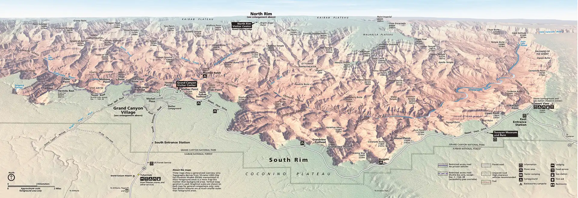
Overview & Orientation
| South Rim Pocket Map & Services Guide | Village streets, Mather Point to Hermits Rest, viewpoints, restrooms, food, parking | South Rim Pocket Map (PDF) (nps.gov) |
| North Rim Pocket Map & Guide | Cape Royal & Point Imperial drive, trails, picnic spots, facilities | North Rim Pocket Map (PDF) (nps.gov) |
| Park Area Map | Entire park plus main approach highways—great for road trippers | Area Map (83 KB PDF) (nps.gov) |
Shuttle & Driving Routes
| Map | Season | File |
| South Rim Shuttle Bus Routes (Blue, Orange, Purple & Red lines) | Spring–Fall timetables | Shuttle Route Map (PNG/PDF) (nps.gov) |
| Desert View Drive Scenic Map | Year-round self-drive east of the village | Desert View Drive Map (PDF) (nps.gov) |
| Trip Planner Map | Hermit Road & Desert View overview with mileages | Trip Planner (PDF) (nps.gov) |
Hiking & Trail Details
| Map/Brochure | Focus Trail(s) | File |
| South Kaibab Day-Hike Sheet | South Kaibab Trail with elevation profile & water points | South Kaibab Trail (PDF) (nps.gov) |
| Introduction to Back-Country Hiking | Corridor, Threshold & Primitive trails—includes small topo | Back-Country Guide (PDF) (nps.gov) |
| Back-Country Use Area Map | Camping zones, permit codes, river corridor | Use Area Map (Poster PDF) (nps.gov) |
| Trail-Specific Sheets – Bright Angel, New Hance, Hermit, etc. | Steepness, hazards, camps, water | Example: New Hance Trail (PDF) (home.nps.gov) |
Note: Most trail sheets include QR codes that open live water-status updates once you regain signal.
Themed And Educational Maps
| Map | Why Download It | File |
| Trail of Time Map | Geology timeline markers along the rim walk—great for kids | Trail of Time Page (interactive) (nps.gov) |
| Desert View Cultural Landscape | Watchtower history walk & pueblo sites | Desert View Brochure (PDF) (nps.gov) |
| Back-Country Campsite Poster | Big-wall print showing every permit zone—ideal for planning | Campsite Poster (PDF) (nps.gov) |
5. Handy How-Tos

Download first, view offline
Cell service drops 30 mi (48 km) south of the rim. Save PDFs to your phone’s files app or cloud drive.

Print trail sheets two-sided
They tuck neatly into a zip-top bag for sweat-proof navigation.

Match the color codes
Shuttle route names (Blue, Orange, Red, Purple) match line colors on the South Rim Pocket Map and stop signs.

Check revision dates
The NPS footer shows month/year—use the newest file to catch detours or seasonal shuttle changes.

Need something specific—like a topo overlay for GPS units or a Spanish-language pocket map? Each NPS download page linked above lists alternate formats right below the main file. Grab what fits, stash it where internet isn’t required, and you’ll navigate the canyon like a ranger from the moment you roll through the gate.